ridehail
Exploratory animation of ridehailing models
Project maintained by tomslee Hosted on GitHub Pages — Theme by mattgraham
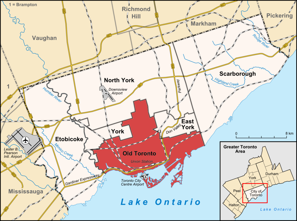
Toronto
Geography
The City of Toronto (also “Metro Toronto”) is more than the “old city” (following amalgamation) but less than “Greater Toronto” which includes surrounding cities such as Mississauge and Brampton.
The City of Toronto includes (areas from Wikipedia):
- Old Toronto (97 km^2)
- East York (21.26 km^2)
- North York (177 km^2)
- Etobicoke York (124 km^2)
- Scarborough (188 km^2)
- York (24 km^2)
Data
From The Transportation Impacts of Vehicle-for-Hire in the City of Toronto (VFH1) and The Transportation Impacts of Vehicle-for-Hire in the City of Toronto: October 2018 to July 2021 (VFH2).
- “The average PTC in-vehicle time was 15 minutes” (VFH1 p 31)
- On Feb 6, 2020: average trip length = 8.13km, P1=40.5%, P2=11.2%, P3=48.3%. (VFH2 p25)
- March 2019: 176,000 daily trips (cf Chicago 300,000).
- 150K trips / day => 7K/hr => 120 / minute
- The inner City (old city of Toronto, and East York) had 60% of trips.
- Average traffic speed in Toronto = 25 kph (in some 2014 study), although the Congestion Trends in the City of Toronto (2011-2014) study done for the City gives speeds more like 35 kph (p39). We do have to include pickup and dropoff times though.
- The average wait time for completed trips in the City of Toronto has dropped from 4.2 minutes in September 2016 to 3.1 minutes in September (VFH1 p15)
- For trip distances, see VFH1 p 13. “almost 50% of trips being less than five kilometres and over 70% less than ten kilometers”.
- Number of vehicles ~ 6000 (very rough) (VFH2 p25).
-
- Average wait times and others (eyeballed from chart on VFH2 p 16). Waiting at pick-up included in P2
Month Wait time Daily vehicles (K) trips/vehicle P3 P2 P1 Jan 2020 2.4 min 26 6.7 47 10 42 Feb 2020 2.4 min 27 6.8 48 11 41 Mar 2020 2.3 min 18 6.1 45 45 10 Apr 2020 3.5 min 6.7 5.9 48 35 17 May 2020 4.2 min 7.5 6.7 55 20 25 Jun 2020 4.0 min 10 6.6 54 19 28 Jul 2020 3.5 min 12 6.9 55 18 27 Aug 2020 3.3 min 13 6.9 56 17 28 Sep 2020 3.1 min 14 6.3 52 15 33 Oct 2020 3.2 min 14 5.5 47 13 41 Nov 2020 3.4 min 13 5.5 47 13 40 Dec 2020 3.6 min 12.5 5.0 45 13 42 Jan 2021 3.4 min 12 4.7 43 12 44 Feb 2021 3.6 min 12 5.2 48 15 37 Mar 2021 3.5 min 13 5.4 47 13 39 Apr 2021 3.5 min 12 5.5 48 14 37 May 2021 4.0 min 11.5 6.0 53 16 31 Jun 2021 4.8 min 12 6.7 51 30 19 Jul 2021 5.8 min 13 6.3 60 20 20
Simulations
See Notebook 2021-12-16.
Taking one block = 1 min ~ 0.5km:
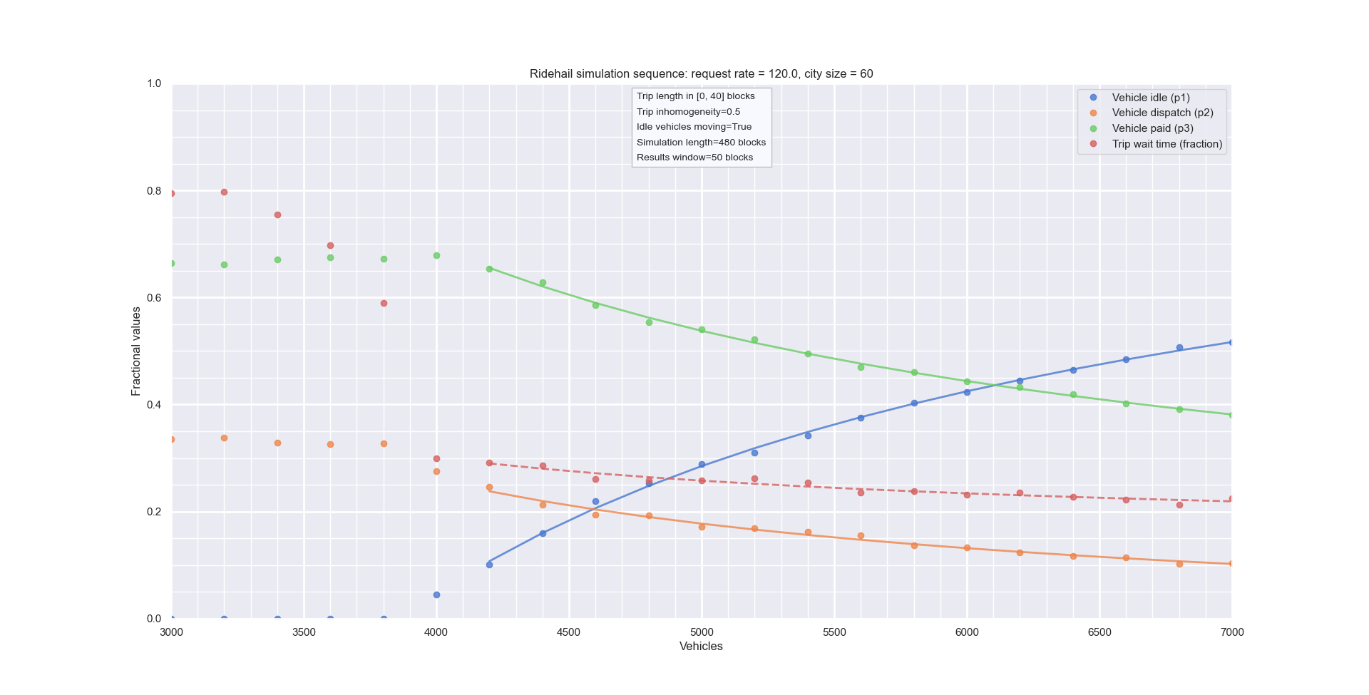
{C = 60,
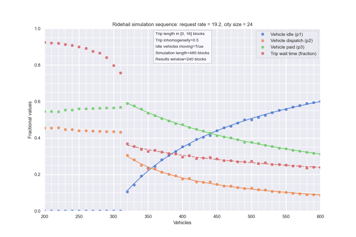
From above: inhomogeneous city:
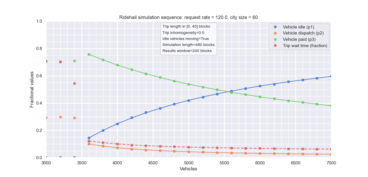
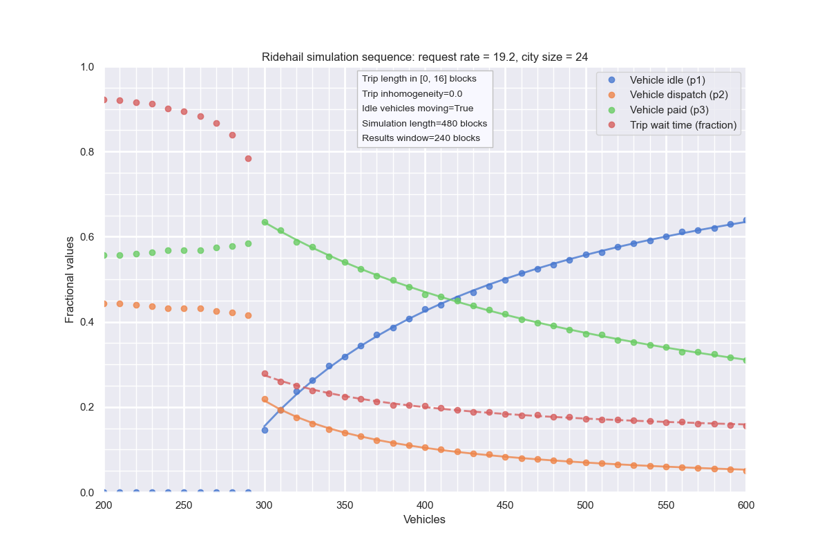
Same, but homogeneous:
Scaling - 24 blocks
THESE ARE WRONG: I SHOULD NOT HAVE SCALED L
Inhomogeneous city:
Homogeneous city:
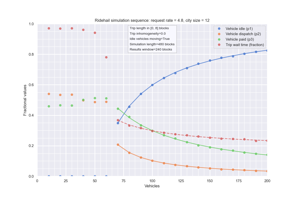
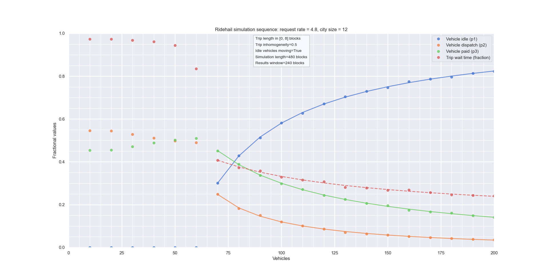
Scaling - 12 blocks
Inhomogeneous city:
Homogeneous city: